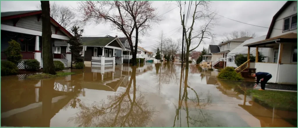
New Jersey has declared a state of emergency as a strengthening low-pressure system organizes into a nor’easter, threatening major coastal flooding along the mid-Atlantic this weekend. The storm is forecast to peak Sunday into Monday, forcing officials to position resources and warn residents in low-lying areas. Evacuations are possible where surge and tides combine with heavy surf.
Steady northeast winds will push battering surf from Virginia up into New England, driving water into bays and barrier beaches. Forecast models point to sustained heavy wind and long periods of onshore flow that will pile waves against the shoreline. Officials say the combination of high tides and persistent swell is the primary danger.
Coastal Flood Watches are in effect for Sunday and Monday with waves expected in the 12 to 15 foot range along exposed coastlines. That kind of surge can elevate tides 2 to 4 feet above normal, flooding roads and low neighborhoods near the water. Beach erosion and dune damage will likely be widespread in vulnerable spots.
“Moderate to Major coastal flood impacts are increasingly likely,” stated forecasters Friday at the office in Mount Holly, New Jersey. “Widespread roadway flooding and impassable roads, inundation of structures, and evacuations are possible Sunday-Monday.”
Forecasters are warning of major dune breaching where the surf is fiercest, which will remove protective sand and expose infrastructure. When dunes fail, homes and roads behind them become far more vulnerable to wave-driven damage. Municipalities along the bay and open ocean shorelines are already evaluating vulnerable stretches.
High Wind Watches cover Long Island through the coasts of New Jersey and Delaware, with sustained east-northeast winds likely in the 25 to 35 mph range near shore. Gusts inland could spike up to about 60 mph in exposed locations, adding to the risk of downed trees and power outages. Those winds will also feed the surf and make conditions hazardous for marine and coastal operations.
New York authorities have suspended Fire Island ferry service for the expected period, and other transit links could face temporary closures if flooding or debris block access points. Officials emphasize people should avoid travel during peak surge times and follow local evacuation orders if issued. Emergency services will be prioritizing rescues and essential supply routes.
Heavy rain will accompany the wind and surge, and coastal belts could see 3 to 5 inches of rain through Tuesday in some areas. Inland, that rainfall plus poor drainage raises the flash flood threat, particularly where soils are already saturated. Stormwater systems and small streams may surge quickly, catching drivers off guard.
The Weather Prediction Center has flagged a Level 2 of 4 flash flood risk for Sunday stretching from Norfolk up through Philadelphia and into the New York metro area and southern New England. That reflects a real chance of rapid, localized flooding in urban corridors and river basins during the heaviest bands. Residents in those zones should monitor official forecasts and prepare to move to higher ground if warnings come.
A state of emergency gives New Jersey officials authority to mobilize resources, stage pumps and sandbags, and coordinate evacuations where necessary. Local leaders are urging people in flood-prone neighborhoods to secure loose items, move vehicles to higher ground, and prepare for power interruptions. Those with medical needs should check continuity plans and stay in close touch with local emergency management.
Officials will keep issuing updated watches and warnings; residents should stay tuned to local emergency channels and sign up for alerts. If you live in a flood-prone area, identify a safe route inland now and be ready to leave on short notice. Local shelter information and instructions will be provided by emergency officials as needed.
